This was going to be a pretty boring post, since Google hasn’t revealed much about Google Earth lately. I expected some big news last week at either Where 2.0 or the Google Developer Day and there was almost nothing said. It was quite a let down.
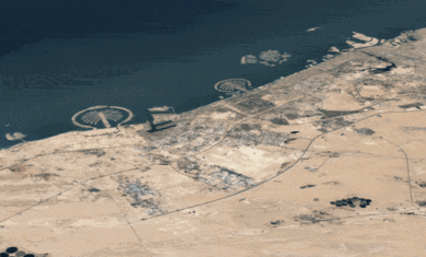
Then this morning Google announced a huge image update! In addition to a ton of new images, they also updated the terrain layer for a few areas as well. This makes pretty 3D terrain (like the Grand Canyon) even better. Here is more info about the new imagery and here is more info about the terrain update.
So where does that put Google Earth? I’d say it’s still a class above Virtual Earth (even before this update), but Microsoft is catching up quickly. What does Google Earth need to do?
In my mind, the biggest missing feature is more HTML in the description bubble. It seems like a small thing, but the implications are huge. Imagine if you could drop a YouTube video in there so show what you looked like skiing down the mountain that someone is looking at. It’d be great! Or how about forms? You could leave comments on files or change settings on a network link without ever having to leave Google Earth (or use the little browser that doesn’t work on many systems).
Next up is better 3D building support. I agree that Google’s 3D buildings look better than the ones Microsoft has. However, Microsoft has thousands more buildings, thus giving them an edge. In addition, I like how Microsoft loads them. Fly to a city and the buildings will pop up pretty quickly in very low res. As you zoom in, the higher resolution data is loaded on top. In GE, it’s high-res or nothing, which can mean quite a wait when you first visit a 3D heavy city like Denver. Once nice thing that GE does that VE is still missing is give you a loading status. In Virtual Earth, you never know if 3D buildings are going to come up in a minute or not – with GE, at least you know.
I consider Google Earth the king, but I love the fact that Microsoft is going to make them work real hard to stay on top. 🙂


The Achilles heal for GE is the lack of a good developers API. GE is in serious trouble from a technology perspective and Google does not want anyone to know how bad it is. GE is wonderful and it will be a shame when VE overtakes them.
You make a good point. However, much of that can be overcome with one simple thing – the network link. It’s much more powerful than most people give it credit for. With a network link and a dynamic KML on a server, you can do a LOT of stuff.
In terms of ease of development, Virtual Earth is still WAY behind. I spent a good deal of time talking with a VE engineer both in person and over a handful of e-mails just to figure out how to create an image overlay with a dynamic image. Hours wasted with no result. I could do the same thing in Google Earth in about two minutes.
Not to say that GE couldn’t have a better API… 🙂