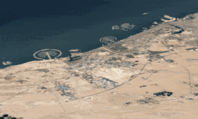
I thought I’d start things out on here by talking about some recent insights and improvements to each of the three main topics on this blog – Microsoft’s Virtual Earth, Google Maps and Google Earth.
We’ll start with Virtual Earth. If you haven’t used it in a few months, you need to go check it out again. It is progressing at an amazing rate of speed. Within just the last few weeks we’ve seen a new version be released (v5) as well as a TON of new data.
Version 5 offers some cool stuff. The most interesting to me is the info box – the description that pops up when you click an item. You can now put any HTML in there that you want, which means forms, videos, photos, etc can all be seen in there. This is also the case with Google Maps, but not with Google Earth where you are very limited on what you can put in there.
Their latest data update was also quite impressive. According to their developer blog, they’ve added 11.5 terabytes of data! This includes new high-res standard data, new bird’s eye data and a bunch of new cities in 3D. It’s quite impressive.
All of that being said, they’re still way behind in a few areas. I attended their “birds of a feather” session at Where 2.0 this week and came out with two very bizarre things.
First, they were showing off some new polygon-related features and how to code them. It looked great, but I didn’t see how to assign altitude to a point so you can have it float in the air or be a side of a cube or whatever. When I asked how it was done, they pretty much just grumbed and shook their heads. I assume it’s coming soon, but right now polygons are flat on the ground.
Next was when they were showing off image overlays. They showed an image overlay on the ground and then tilted down so we could see how it followed the flow the terrain. There was an audible gasp in the room from being people so impressed. My reaction was WTF? Google Earth has been doing this for almost two years now. It’s nice that VE does it now too, but why was it such a big deal? I still haven’t figured that one out.
One other nice thing they showed off was how you can “rubberize” image overlays – stretch and skew them to fix whatever area you want. This is sorely lacking from Google Earth and it was well-implemented. On the flip side, it’s a pain in the butt to add any image overlay, whereas Google Earth makes it simple.
All in all, Virtual Earth is something to keep an eye on. I’m very pleased they’re working so hard on this, as it’ll only serve to push Google even harder. Also, the 3DConnexion SpaceNavigator is a must-have for VE, as Frank Taylor explains here. It’s a must-have for Google Earth as well, but GE tends to have a bit better mouse control. The mouse control in VE is quite awful, but the SpaceNavigator makes it much
better.

